RF Satellites
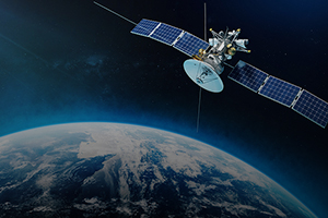
A new generation of satellites is making it easier to track human activity on the ground using timestamped radio signals. Known as cubesats, the satellites are a standard design that can be outfitted with whatever electronics are needed for the job, and their small size greatly reduces the cost of deployment.
One example is a constellation of three satellites that was launched in 2018. They fly in a triangular formation, covering a path about 1,200 miles (2,000 km) wide in an orbit that takes them over both poles, so as the Earth revolves, every point on the surface passes beneath them several times a day. The satellites use a combination of trilateration (measuring small differences in the time it takes for a signal to reach each member of the cluster) and the Doppler effect (the change in signal frequency as it moves relative to a receiver) to pinpoint the origin of a signal to within 500 meters (less than one-third of a mile).
In addition to cost, a major advantage of RF satellites over those equipped with high-resolution cameras is that they can “see” through clouds by picking up satellite phone signals, walkie-talkies, and all types of radar. This enables them to track, for example, unauthorized ships, fishing boats, and other marine craft even if they have turned off their automatic identification systems to avoid being detected. The technology will also be instrumental in cataloging radar-pulse fingerprints for all types of vessels, since small differences in components can generate a unique radio signature that would otherwise be imperceptible.
For information: Hawkeye 360, 196 Van Buren Street, Suite 450, Herndon, VA 20170; phone: 571-203-0360; email: sales@he360.com; Web site: HawkEye 360 - Satellite-based GEOINT Technology, AIS Ship Tracking RF (he360.com)